Watch Duty’s Smoke Layer Shows Where Wildfire Smoke is Headed, up to 48 Hours in Advance
Wildfire smoke can reach your bike route, your kid’s soccer game, or your weekend barbecue, even when the fire itself is far away. Today, Watch Duty launched a new Smoke Layer in the app, so everyone can see where potential smoke is forecast and plan around it.
Powered by OpenSnow, the new Smoke Layer uses NOAA's High-Resolution Rapid Refresh (HRRR) Smoke model. It brings smoke forecasts to the Watch Duty map for the first time, updated every hour with visibility for up to 48 hours in the future.
“Most people dealing with wildfire smoke are miles from the fire itself, deciding whether to go on a run or when is best to make a family trip to a playground,” said Brian Harris, Watch Duty Chief Product Officer. “We built the Smoke Layer so that the forecast for smoke is on-hand for everyone to make the right decisions for their family’s wellbeing. ”
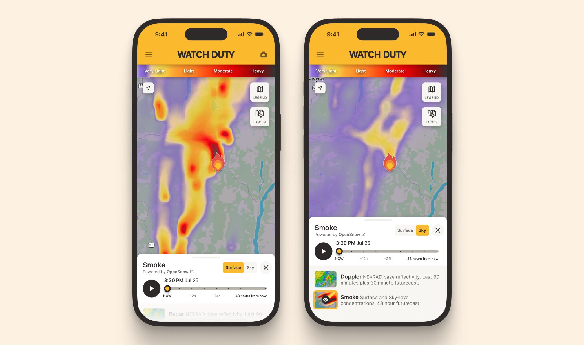
You can use the Smoke Layer in Watch Duty to track two different views of wildfire smoke: Surface Smoke and Sky Smoke.
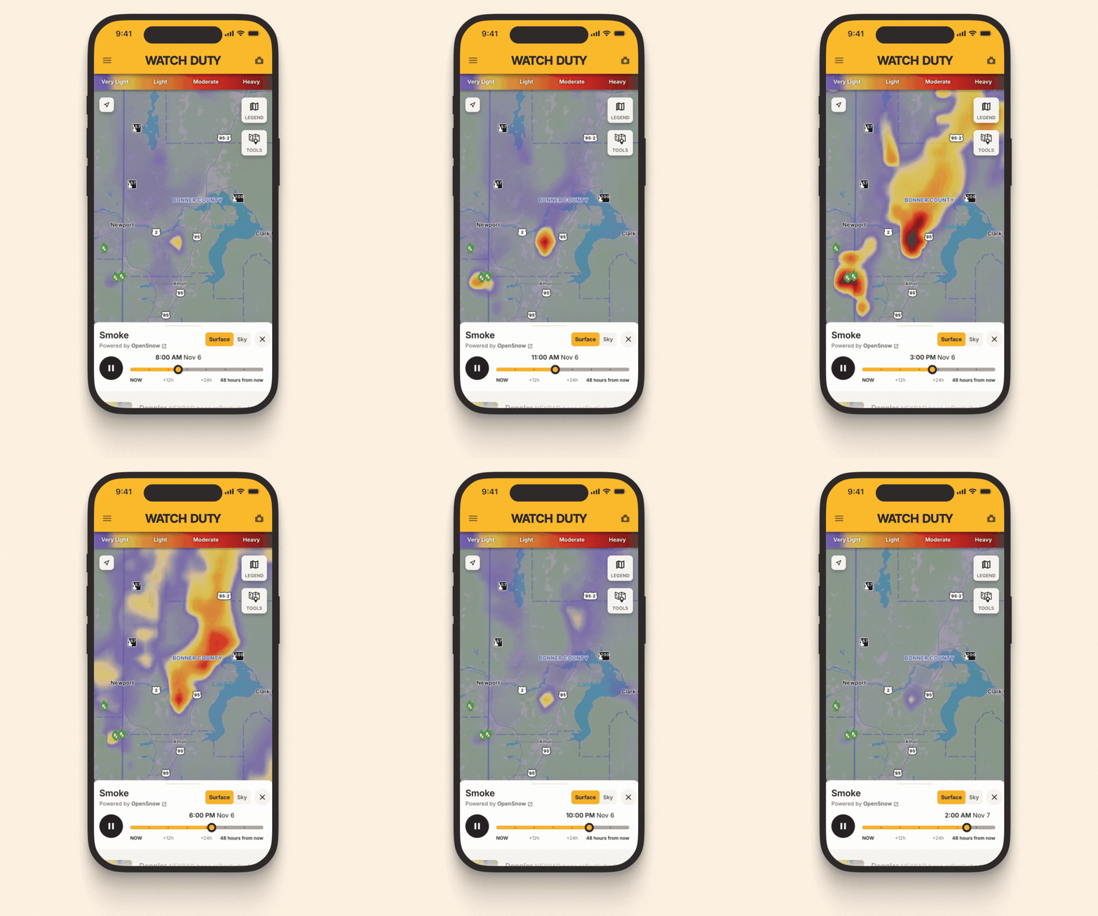
Use Surface Smoke to help plan outdoor activities based on where and when smoke may affect the air you breathe. This view shows predicted smoke concentrations near ground level.
For the full picture of the air around you, pair the Surface Smoke view with the Air Quality Index (AQI) Layer; Surface Smoke shows where smoke concentrations are headed, and the AQI Layer gives you a complete picture of air quality.
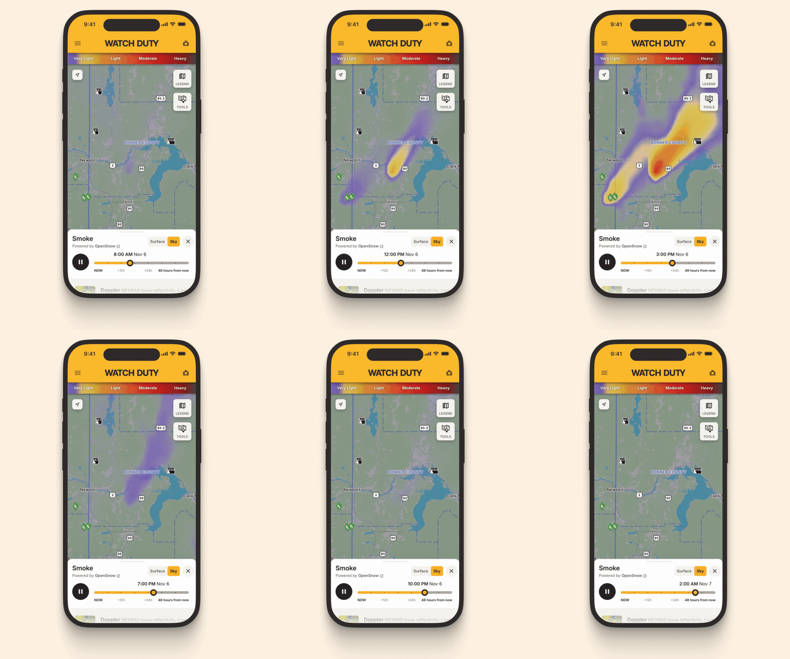
Use Sky Smoke to see where smoke may create hazy skies or reduce visibility, which can matter for travel.
It shows the total amount of smoke in the atmosphere above an area, including smoke high overhead.
How to view smoke layers
- Open the Watch Duty map.
- Select Radar → Smoke.
- Choose Surface Smoke or Sky Smoke.
- Use the timeline controls to explore how smoke conditions are expected to change.
You can move through the forecast manually or use playback to visualize anticipated smoke movement over time.
The Smoke Layer is currently available in the contiguous United States (the lower 48 states and Washington, D.C.).