Utilities
Situational Awareness That Cuts Through The Noise
We are ready to go, where you need us.
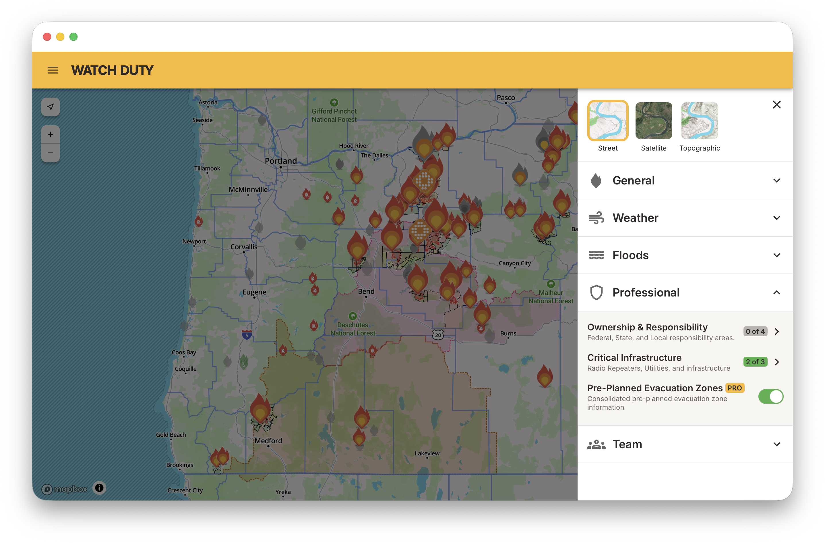
Watch Duty brings together verified incident intelligence, infrastructure context, weather conditions, evacuation information, and operational layers into a single operational view.

"With Watch Duty's Team functionality, our teams at Xcel can focus more quickly on operational decision making and resource coordination."
Chance Hutson
Xcel Senior Manager, Wildfire Investigations
When wildfires, floods, severe weather, and power disruptions threaten critical infrastructure, every minute matters.
Utilities often manage emergencies across multiple systems, but when critical information lives in separate tools, teams spend valuable time assembling a picture of what's happening.
Watch Duty helps utility operators, transmission planners, emergency response teams, and field crews stay ahead of rapidly changing conditions with verified incident intelligence, infrastructure context, and operational awareness in one platform.
Why your team needs Watch Duty:
Utility operations depend on faster decisions
While hardware solutions are geographically bound and difficult to scale across expansive service grids, Watch Duty deploys instantly across your entire territory to provide comprehensive, highly responsive coverage.
Predictive models excel at forecasting but are not nimble enough to keep up post-ignition for ongoing incident management.
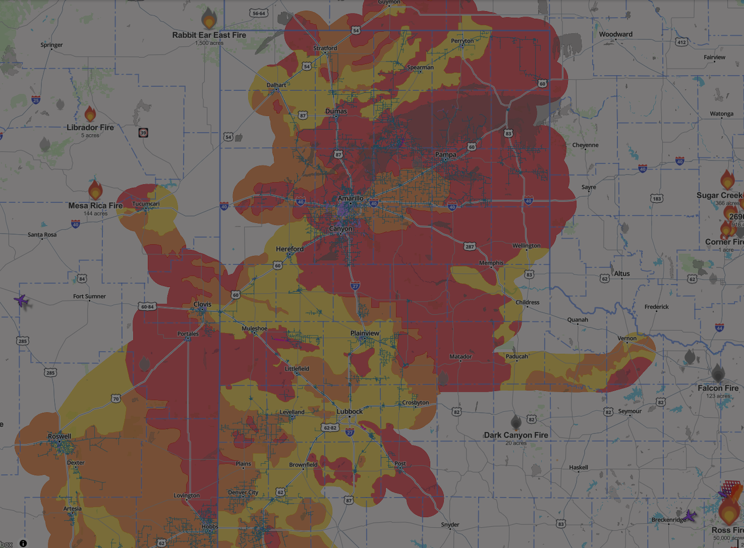
Watch Duty serves as a live operational layer, tracking exactly where a fire is moving relative to infrastructure right now.
Communication across departments can be delayed without shared team access
Maintain situational awareness across departments, so that everyone stays informed across the chain of command.
"Now that we have Watch Duty Enterprise, we have our asset layer in there as well as the outage information. Being able to see all that in real time as the fire is popping up saves a tremendous amount of time."

Andy Abranches
VP Wildfire Mitigation, PG&E
Equip your team with:
01
Custom GIS Layers
Bring your own infrastructure data directly into Watch Duty to eliminate time-wasting toggling between tabs.
02
Critical Infrastructure Context
Visualize utility assets alongside active incidents to right-size responses by field crews.
03
Weather & Environmental Monitoring
Track conditions affecting operations and risk so that field crews work from an aligned up-to-date picture to mitigate impacts as quickly as possible.
04
Fire Progression Models
Understand potential incident movement faster than ever before, reducing safety hazards for your team.
Protect critical infrastructure like:
Transmission corridors
Substations
Generation facilities
Distribution assets
Fuel and gas infrastructure
How Xcel Energy is scaling safely
with Watch Duty
.jpg)
Improve Emergency Operations
Provide dispatchers, operations centers, and field personnel with a common operating picture during fast-moving incidents.
Support Public Safety Power Shutoffs (PSPS) and Restoration Planning
Combine incident activity, weather conditions, infrastructure context, and field observations to better inform operational decisions.
Easy Integrations
Access data from joint partners like Planet, Wet Dog Weather, and Overstory for high-resolution imagery, radar and vegetation risk assessment.


"Watch Duty can save our teams anywhere from 15 to 30 minutes during the critical first hour of an event."
Chance Hutson
Xcel Energy Senior Manager, Wildfire Investigations
Get operational with Watch Duty
14 days post-kickoff.
Bring your GIS layers, service territories, and operational teams into one shared platform.