
Watch Duty Integrates with Planet to bring High-Resolution Satellite Imagery to Enterprises Like PG&E for Improved Decision Making
As the 2026 wildfire season continues to reveal longer and more destructive activity across the U.S, companies with significant infrastructure like utilities and telecommunications firms are relying on accurate, real-time information to make critical de-energization and field coordination decisions.
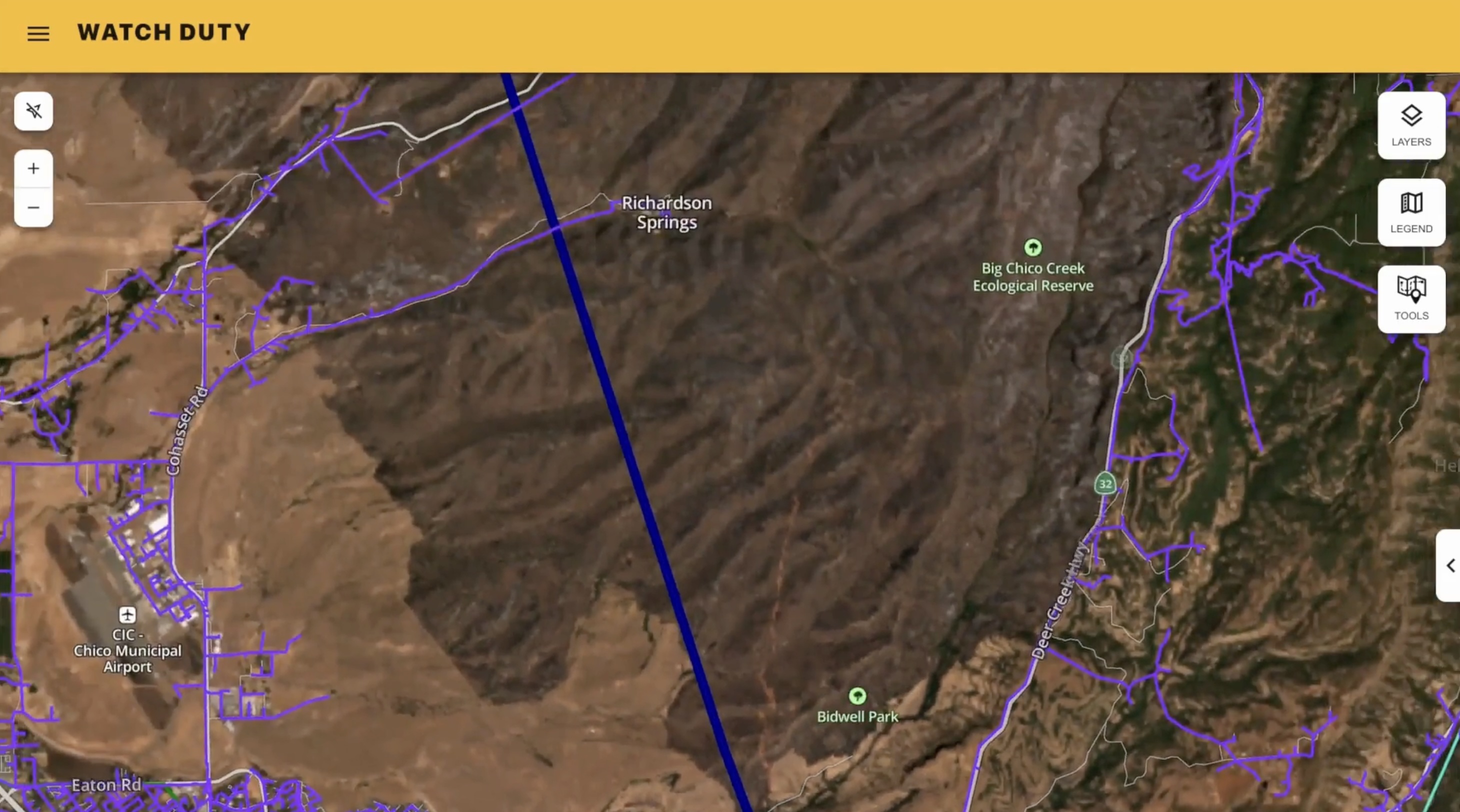
Watch Duty is integrating Planet's high-resolution weekly satellite mosaics as a map layer available within Watch Duty's enterprise environment. Mutual enterprise customers who use this feature gain access for significantly more current on the ground reporting than existing satellite mapping solutions, which can be months but often years out of date.
Planet satellite imagery is overlaid on Watch Duty operational context, including incident data on wildfires and major floods, human-validated reporting, enterprise asset mapping, strengthening pre- and post-incident situational awareness for critical infrastructure clients. Now, Watch Duty enterprise customers leveraging Planet’s satellite data will have more current vegetation and fuel load visibility, as well as higher infrastructure corridor awareness. This higher resolution allows for better post-incident burn scar or flood damage assessment, with the potential to enable faster post-event damage restoration planning.
"When managing wildfires, time is of the essence," said Will Marshall Co-Founder and CEO of Planet. "This integration combines Watch Duty's vital on-the-ground context with Planet's overhead view, empowering teams at utilities like PG&E to move from reactive crisis management to proactive solutions to help protect people, property, and the environment."
“This layer is the most current on the market, so partners have enhanced visibility into critical infrastructure risks,’ said John Mills, Cofounder and CEO of Watch Duty. “Planet’s satellite data gives our enterprise customers a better look at current vegetation conditions, roadways, burn scars, and fuel breaks, all of which play key roles in critical decision making.”
Pacific Gas and Electric Company (PG&E) has become the first adopter of the new integration features, utilizing the technology for more current, high-resolution imagery of its service area directly within Watch Duty's common operating picture. This gives PG&E teams a stronger baseline to assess vegetation conditions, identify changes to terrain, evaluate road and route changes, and support any needed incident investigations, all in context of their existing distribution and transmission line layers.
"Our teams rely on timely, accurate information to understand wildfire events and conditions in the field. Having access to more current satellite imagery alongside our infrastructure in Watch Duty helps us build a more complete picture, make informed decisions and continue strengthening our wildfire mitigation efforts,” said PG&E Wildfire Mitigation Vice President Andy Abranches.
The organizations expect to collaborate on additional capabilities over time, including enhanced mapping, analysis, and broader disaster response applications. While PG&E is the first user of this integration, this feature is available for any Watch Duty and Planet enterprise customer, designed especially for utilities, telecom infrastructure operators, and critical infrastructure managers.
Learn more about Watch Duty Enterprise Solutions.


.jpg)
.png)